Gm metro ruralline archive: различия между версиями
м (→Map information: v29d map edit) |
(rebuild whole wikitext: Removed v30 / redux related stuff) |
||
| Строка 1: | Строка 1: | ||
== gm_metro_ruralline information == | == gm_metro_ruralline information == | ||
| − | Ruralline is an unusual Metrostroi map due to it primarily being an overground map. It is a map that connects rural parts of ex-USSR territory in a scenery-dense environment. Between most stations, there is a 60-70 km/h speed limit under a 2/6 ALS frequency | + | Ruralline is an unusual Metrostroi map due to it primarily being an overground map. It is a map that connects rural parts of ex-USSR territory in a scenery-dense environment. Between most stations, there is a 60-70 km/h speed limit under a 2/6 ALS frequency. |
| − | The Ruralline is a nickname for the whole metro line, which is named the Blueline. It consists of 7 total stations, with one station out of service | + | The Ruralline is a nickname for the whole metro line, which is named the Blueline. It consists of 7 total stations, with one station out of service |
'''City and Transit Authority Information''' | '''City and Transit Authority Information''' | ||
| − | [[Файл: | + | [[Файл:Rockport-trasnitlogo.png|200px|thumb|Rockport transit logo]] |
Rockport Transit is the primary public transportation operator in the city of Rockport. The company is dated back to 1930, with the oldest lines of D1-D3. Currently, the RTA operates 42 bus lines, 10 tram lines, and 10 subway lines. | Rockport Transit is the primary public transportation operator in the city of Rockport. The company is dated back to 1930, with the oldest lines of D1-D3. Currently, the RTA operates 42 bus lines, 10 tram lines, and 10 subway lines. | ||
| Строка 17: | Строка 17: | ||
;gm_metro_ruralline | ;gm_metro_ruralline | ||
: update v29 (Current Map Version) [http://steamcommunity.com/sharedfiles/filedetails/?id=873230929 Steam Workshop link] | : update v29 (Current Map Version) [http://steamcommunity.com/sharedfiles/filedetails/?id=873230929 Steam Workshop link] | ||
| − | : update | + | : update <Final> (Upcoming Map Version) <del>Steam workshop link</del> Last update to fix V29's bugs and issues |
;Content Pack | ;Content Pack | ||
: This pack has every map versions signals and station announcer files (v29). Content pack updates as map gets updated. | : This pack has every map versions signals and station announcer files (v29). Content pack updates as map gets updated. | ||
: [http://steamcommunity.com/sharedfiles/filedetails/?id=1106398117 Steam Workshop link] | : [http://steamcommunity.com/sharedfiles/filedetails/?id=1106398117 Steam Workshop link] | ||
'''Please be advised that Ruralline requires a lot of extra items. This will be rectified in a future update.''' | '''Please be advised that Ruralline requires a lot of extra items. This will be rectified in a future update.''' | ||
| − | [[Файл:Blueline line graph.png|300px|thumb|right|Ruralline Map with Upcoming Areas]] | + | <nowiki>[[Файл:Blueline line graph.png|300px|thumb|right|Ruralline Map with Upcoming Areas]]</nowiki> |
==Map information== | ==Map information== | ||
| Строка 34: | Строка 34: | ||
|navbar mini=1 | |navbar mini=1 | ||
|map= | |map= | ||
| − | + | uENDEa~~ ~~ ~~ End of line | |
utBHFaf~~Market Street | utBHFaf~~Market Street | ||
uetBHF~~Ravenholm | uetBHF~~Ravenholm | ||
| Строка 47: | Строка 47: | ||
\utABZg+l\utCONTfq~~ ~~ ~~Depot | \utABZg+l\utCONTfq~~ ~~ ~~Depot | ||
utKBHFxe~~Rocklake | utKBHFxe~~Rocklake | ||
| − | |||
|navbar=gm_metro_ruralline_v29 | |navbar=gm_metro_ruralline_v29 | ||
|navbar pos=2 | |navbar pos=2 | ||
| Строка 57: | Строка 56: | ||
! stations closed | ! stations closed | ||
! map version | ! map version | ||
| − | |||
| − | |||
|- | |- | ||
| style="text-align: center;" | Blueline | | style="text-align: center;" | Blueline | ||
| Строка 64: | Строка 61: | ||
| style="text-align: center;" | 1 | | style="text-align: center;" | 1 | ||
| style="text-align: center;" | v29 | | style="text-align: center;" | v29 | ||
| − | |||
| − | |||
| − | |||
| − | |||
| − | |||
| − | |||
| − | |||
| − | |||
| − | |||
| − | |||
| − | |||
| − | |||
| − | |||
|} | |} | ||
| − | |||
| − | |||
| − | |||
| − | |||
== Stations == | == Stations == | ||
| − | '''Market street | + | '''Market street''' |
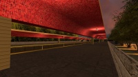
| − | [[Файл:Market Street station platform area.jpeg| | + | [[Файл:Market Street station platform area.jpeg|200px|thumb|right|Market street]] |
Market street is end point of Blueline due Souce engine limitations. | Market street is end point of Blueline due Souce engine limitations. | ||
Market street is located in old Harbor market place area. Nowdays Market street has only Living houses and some small numbers of shops. the market placed is located nowdays in new area. The station itself is build in 1965 when Blueline was opened in 21.06.1966. Station is longest stations in whole line due Older platform area was closed in 1986 due Roof collapsing danger. New platform section was opened same day. | Market street is located in old Harbor market place area. Nowdays Market street has only Living houses and some small numbers of shops. the market placed is located nowdays in new area. The station itself is build in 1965 when Blueline was opened in 21.06.1966. Station is longest stations in whole line due Older platform area was closed in 1986 due Roof collapsing danger. New platform section was opened same day. | ||
| Строка 93: | Строка 73: | ||
Ravenholm is closed station of mainline. | Ravenholm is closed station of mainline. | ||
Station is located few meters away from Martket street station, Station was closed due Low ridership numbers and too near other station. | Station is located few meters away from Martket street station, Station was closed due Low ridership numbers and too near other station. | ||
| − | |||
| − | |||
===Aviation University=== | ===Aviation University=== | ||
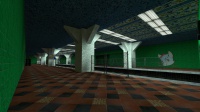
[[Файл:Aviation university.jpg|200px|thumb|right|Aviation university station]] | [[Файл:Aviation university.jpg|200px|thumb|right|Aviation university station]] | ||
| Строка 104: | Строка 82: | ||
[[Файл:City hall station.jpg|200px|thumb|right|City hall station]] | [[Файл:City hall station.jpg|200px|thumb|right|City hall station]] | ||
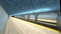
City hall station is oldest one in whole line, Building was build in 1921 as City Hall for Rockport, Station was build to basement of Building. | City hall station is oldest one in whole line, Building was build in 1921 as City Hall for Rockport, Station was build to basement of Building. | ||
| − | + | Now days Rockport's City hall is located in Downtown. | |
| − | |||
===White Forest=== | ===White Forest=== | ||
[[Файл:White forest station.jpg|200px|thumb|right|White forest station]] | [[Файл:White forest station.jpg|200px|thumb|right|White forest station]] | ||
| Строка 111: | Строка 88: | ||
White forest was build in same year as rest of stations, | White forest was build in same year as rest of stations, | ||
But Blueline ended to White forest due from 1880 - 1971 a Freight line was using tracks between Urban park - "unnamed station". Freight line was closed in 1981 due low numbers of goods. | But Blueline ended to White forest due from 1880 - 1971 a Freight line was using tracks between Urban park - "unnamed station". Freight line was closed in 1981 due low numbers of goods. | ||
| − | White forest has it's own kind | + | White forest has it's own kind design |
===Urban park=== | ===Urban park=== | ||
[[Файл:Urban park station.jpg|200px|thumb|right|Urban park station]] | [[Файл:Urban park station.jpg|200px|thumb|right|Urban park station]] | ||
| Строка 117: | Строка 94: | ||
Urban park was build after 1971 when freight line closed. Freight lines original track switch is still in same place, But can't be used. | Urban park was build after 1971 when freight line closed. Freight lines original track switch is still in same place, But can't be used. | ||
Urban park is big station without ticket office and everything else. | Urban park is big station without ticket office and everything else. | ||
| − | |||
===Rocklake=== | ===Rocklake=== | ||
[[Файл:Rocklake station.jpg|200px|thumb|right|Rocklake station]] | [[Файл:Rocklake station.jpg|200px|thumb|right|Rocklake station]] | ||
Rocklake is located in small town next of pond named Rocklake. Rocklake station is old and in very bad shape due low maintenance in station. | Rocklake is located in small town next of pond named Rocklake. Rocklake station is old and in very bad shape due low maintenance in station. | ||
| − | Rocklake station was build in 1972 and was opened in summer of 1972 with rest of Blueline. | + | Rocklake station was build in 1972 and was opened in summer of 1972 with rest of Blueline. |
| − | |||
| − | |||
| − | |||
| − | |||
| − | |||
| − | |||
| − | |||
| − | |||
| − | |||
| − | |||
| − | |||
| − | |||
| − | |||
| − | |||
| − | |||
| − | |||
| − | |||
Версия 07:25, 17 июля 2018
gm_metro_ruralline information
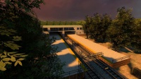
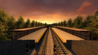
Ruralline is an unusual Metrostroi map due to it primarily being an overground map. It is a map that connects rural parts of ex-USSR territory in a scenery-dense environment. Between most stations, there is a 60-70 km/h speed limit under a 2/6 ALS frequency.
The Ruralline is a nickname for the whole metro line, which is named the Blueline. It consists of 7 total stations, with one station out of service
City and Transit Authority Information
Rockport Transit is the primary public transportation operator in the city of Rockport. The company is dated back to 1930, with the oldest lines of D1-D3. Currently, the RTA operates 42 bus lines, 10 tram lines, and 10 subway lines.
Map Version history
- gm_metro_rural_line
- update 1 (Release Version) Steam Workshop link
- update 2 - 2.7 (Updated Versions)
Steam Workshop link"Not uploaded to Workshop." - gm_metro_rural_line_2
- update v28 (2.8) (Old Release) Steam Workshop link
- gm_metro_ruralline
- update v29 (Current Map Version) Steam Workshop link
- update <Final> (Upcoming Map Version)
Steam workshop linkLast update to fix V29's bugs and issues - Content Pack
- This pack has every map versions signals and station announcer files (v29). Content pack updates as map gets updated.
- Steam Workshop link
Please be advised that Ruralline requires a lot of extra items. This will be rectified in a future update. [[Файл:Blueline line graph.png|300px|thumb|right|Ruralline Map with Upcoming Areas]]
Map information
| |||||||||||||||||||||||||||||||||||||||||||||||||||||||||||||||||||||||||||||||||||||||||||||||||||||||||||||||||||||||||||||||
| Line | "num" of Stations open | stations closed | map version |
|---|---|---|---|
| Blueline | 6 | 1 | v29 |
Stations
Market street
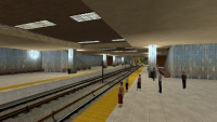
Market street is end point of Blueline due Souce engine limitations. Market street is located in old Harbor market place area. Nowdays Market street has only Living houses and some small numbers of shops. the market placed is located nowdays in new area. The station itself is build in 1965 when Blueline was opened in 21.06.1966. Station is longest stations in whole line due Older platform area was closed in 1986 due Roof collapsing danger. New platform section was opened same day. Station is planed to get name change, Due Ravenholm station will be moved into same place to be Big station. Upcomming name will be Ravenholm/market street.
Ravenholm
Ravenholm is closed station of mainline. Station is located few meters away from Martket street station, Station was closed due Low ridership numbers and too near other station.
Aviation University
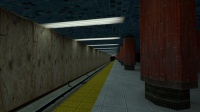
Aviation university "Short; Aviation" is old internation airport of Rockport what was turned into School. Aviation station serves students and people who live near aviation. Aviation station is build same year as Market street station. Aviation was rebuild in 1995 as Airplane come thur station roof of overshuting Runway.
City Hall
City hall station is oldest one in whole line, Building was build in 1921 as City Hall for Rockport, Station was build to basement of Building. Now days Rockport's City hall is located in Downtown.
White Forest
White forest is last/first station of Rockports city limits. White forest was build in same year as rest of stations, But Blueline ended to White forest due from 1880 - 1971 a Freight line was using tracks between Urban park - "unnamed station". Freight line was closed in 1981 due low numbers of goods. White forest has it's own kind design
Urban park
Urban park is a weird station due Station is located in forest. Still Urban park has high ridership as out-skirts station. Urban park was build after 1971 when freight line closed. Freight lines original track switch is still in same place, But can't be used. Urban park is big station without ticket office and everything else.
Rocklake
Rocklake is located in small town next of pond named Rocklake. Rocklake station is old and in very bad shape due low maintenance in station. Rocklake station was build in 1972 and was opened in summer of 1972 with rest of Blueline.
